Directional Drilling in Columbia
Two rivers become a third in the middle of this capital — the Broad and Saluda joining to make the Congaree beside downtown's bridges — and the metro spreads across three kinds of ground: granite country north, the ancient dune belt of the Sandhills through the middle, and old-growth floodplain south. Midlands HDD is three-band drilling in South Carolina's capital — and it's ours.
HDD is the whole job here
The Midlands drill in three bands, and the bands run corner to corner: northwest, granite country — Fairfield's quarries cut the state's famous blue stone, and hard crystalline rock rides close beneath thin red cover across the upper counties; through the middle, the Sandhills — the relict dune belt that arcs across the metro, deep droughty sands that swallow rigs' fluid and give Fort Jackson its training ground; southeast, the floodplain world — the Congaree's bottomlands running to the old-growth forest the national park protects, soft alluvium under wetland seriousness. The capital itself sits where the bands and the rivers meet, and three-band quoting names which country your alignment crosses — because a granite number in the Sandhills, or either in the bottoms, is an estimate telling a story about somewhere else.
The market runs on capital gravity: state government's campus mass, the university's downtown expansion, a medical corridor serving the Midlands whole — and the post: Fort Jackson trains more soldiers than any installation in the Army, giving the metro a training-post cadence all its own, with gate-area coordination, graduation-week traffic rhythms, and a contractor community fluent in the machinery. Lexington's boom rides Lake Murray — the great mile-long dam impounding one of the Southeast's storied reservoirs — while Kershaw balances Camden's steeplechase heritage with corridor logistics, and Fairfield's energy-country north carries its own industrial register. Growth runs Carolina-steady across it all.
The rivers organize everything: the Broad and Saluda arrive from their separate countries, join at the fall of the land beside downtown — the rocky shoals where the city was planted — and the Congaree carries their water south past the park's cathedral forest. Behind everything sits the network desk — 50,000+ boring calls answered, ~10,000 crossings quoted, 2,000+ drilled — pricing the Midlands with the bands already in the math.
Fiber-Optic Boring
Capitol and campus duct, post-corridor laterals, and FTTH across the bands.
Electrical Duct Boring
Feeders for the capital's campuses, the lake's boom, and the energy-country north.
Water & Force-Main Boring
Pressure pipe for capital systems from the shoals to the Sandhills.
Congaree River & Confluence Crossings
The signature Midlands bore: the rivers that meet downtown and the park water south.
Road & Highway Crossings
The capital's grid, three interstates, and six counties' roads — band-named, priced honestly.
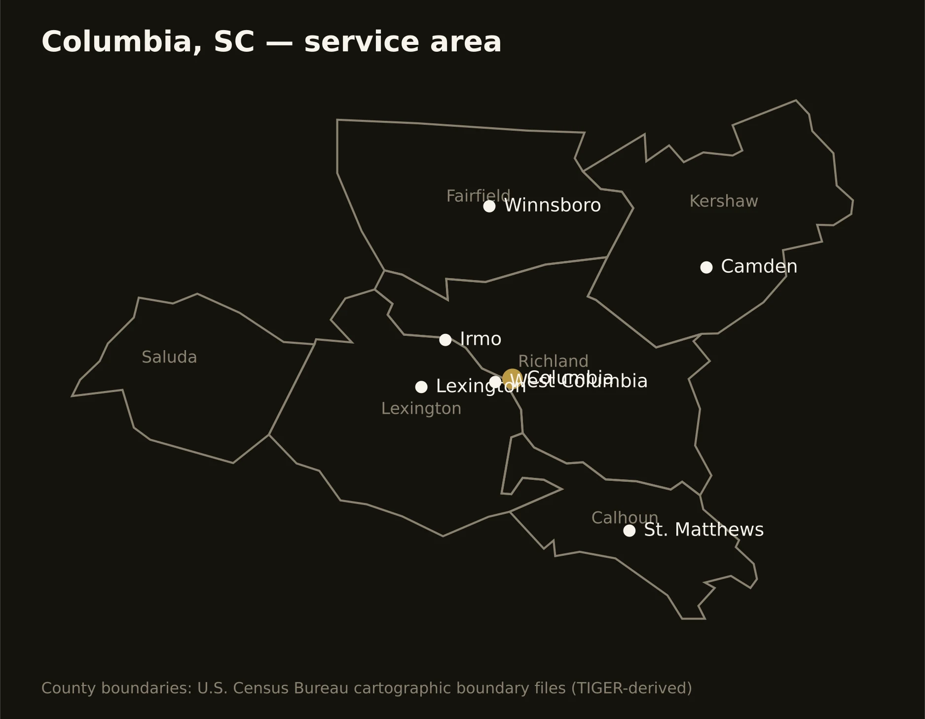
Six counties across the bands — Richland with the capital, the post, and the park's floodplain; Lexington on Murray's shore; Kershaw carrying Camden's horse country; Fairfield's granite north; and Saluda and Calhoun rounding the lake country and the southern flats. Full county list on the service-area page.